
TerraFlare: Uniting Air, Fire, and Community
PROJECT OVERVIEW
The project introduces an integrated ecological infrastructure composed of fire breaks, a rammed-earth fire dike, and a pair of Direct Air Capture (DAC) towers in the wildfire-prone Angeles National Forest, California.
The design originates from an exploration of ‘Climate Uncertainties,’ with a focus on addressing climate challenges and envisioning a decarbonized and decolonized future from diverse perspectives. It delves into specific cases, people, and circumstances, employing microhistory to study the direct air capture technology in Iceland and wildfire events in Indonesia with intensity. This approach creates a powerful focal point by collecting and analyzing various historical strands, thus lending significant force to the study. The microhistory element reveals potential synergies between wildfire management and carbon emissions, inspiring a new project typology to address climate uncertainties effectively.
ABOUT THE PROJECT
Location | Los Angeles, CA |
Area of site | 3.05 billion ft2 |
Date | 2024 |
Status of the project | Concept |
Tools used | Rhino, QGIS, Twinmotion, Photoshop, Illustrator, etc |
Design Team | Haochen He, Haoyang Li |
The research begins by examining the relationship between climate uncertainties and existing response strategies ... ...
RESEACH PROCESS
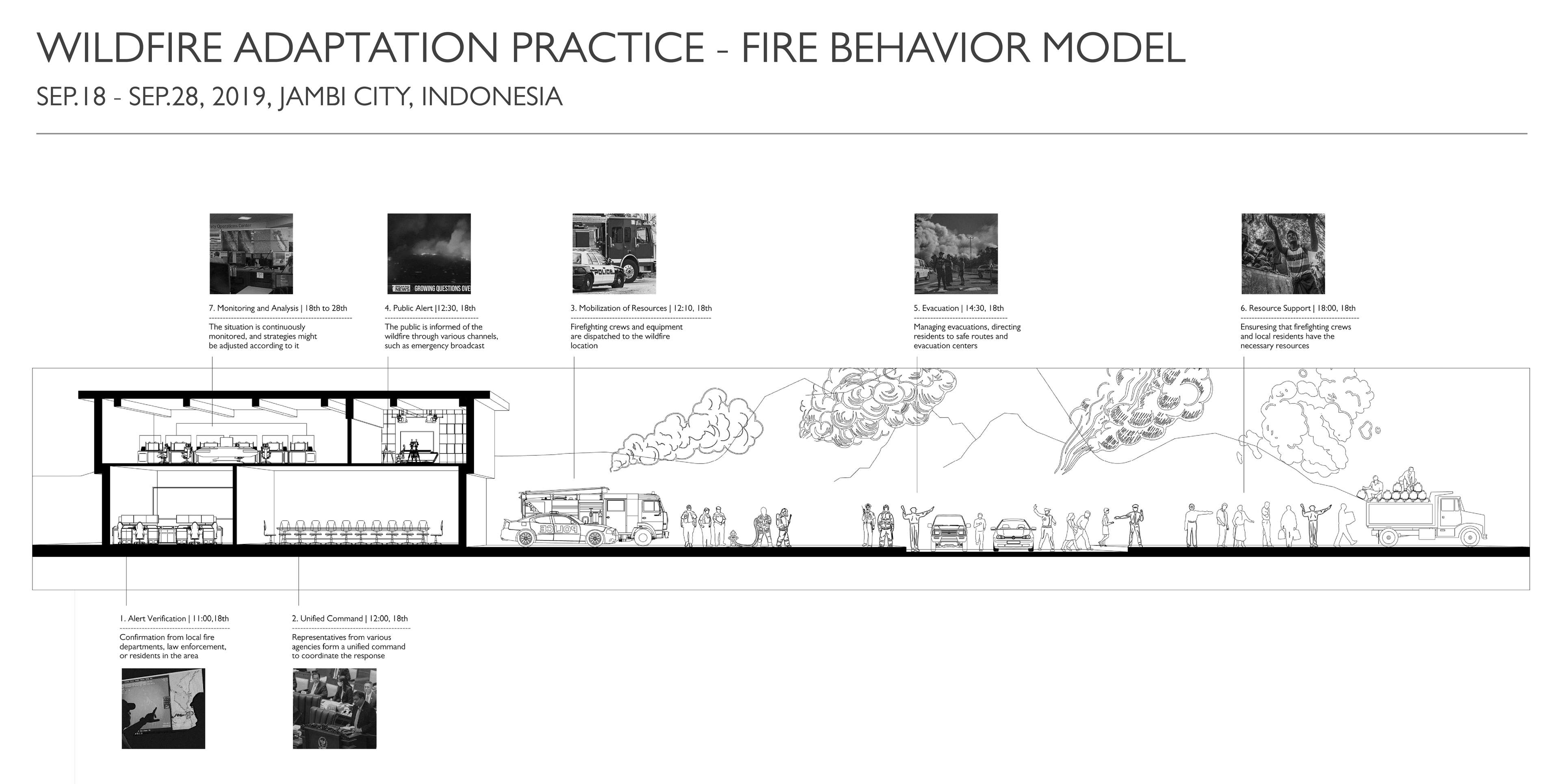
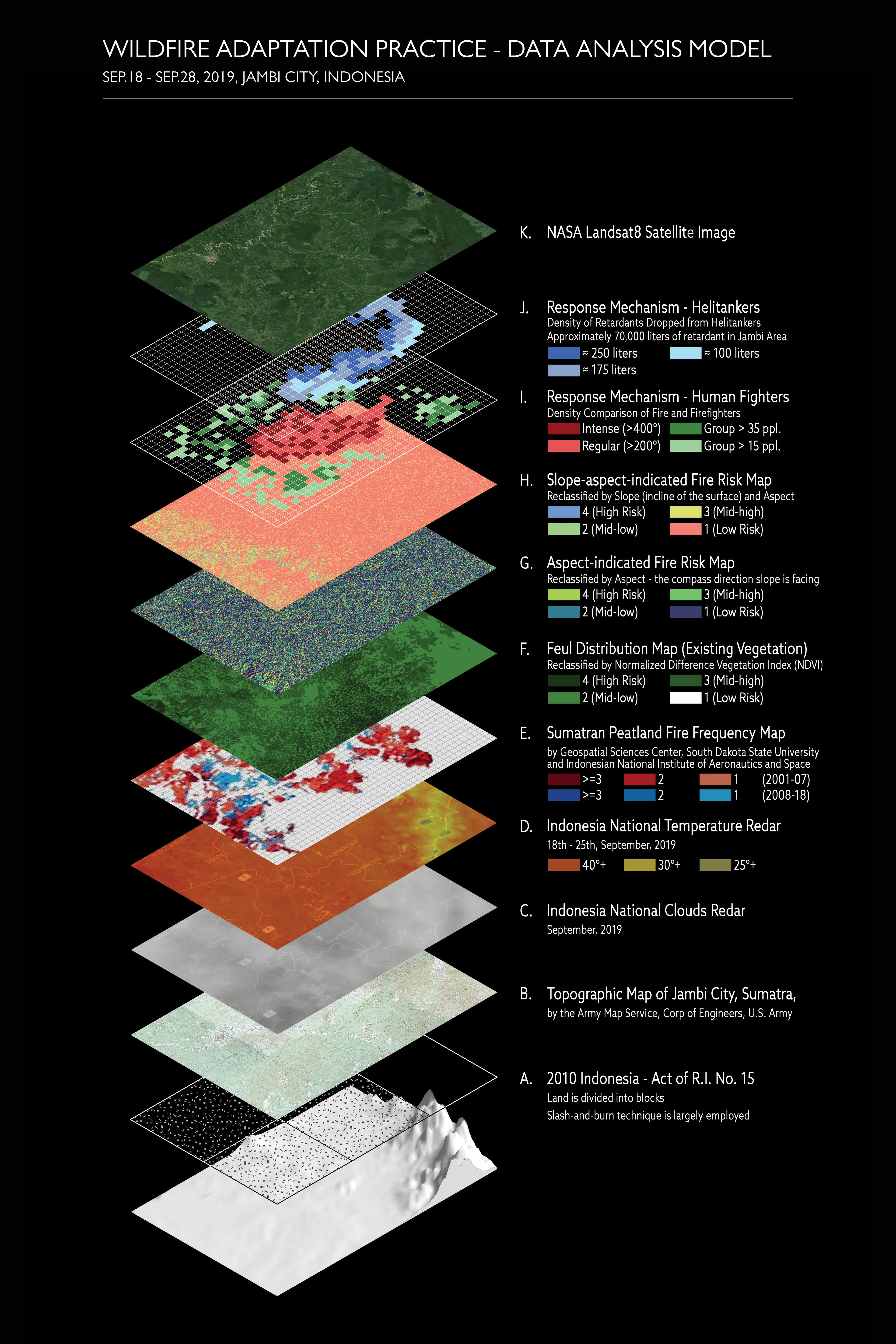
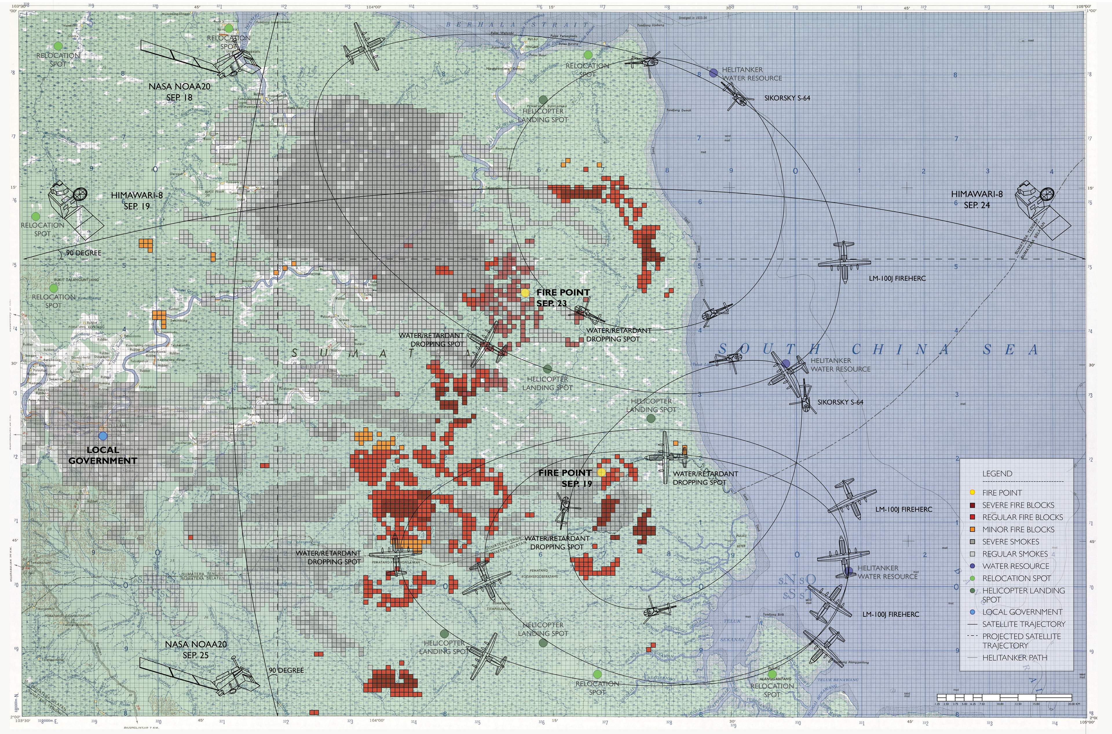
The research and analysis start by elaborating on the wildfire crisis in Sumatra, highlighting the deployment of firecast technology for effective management. The technology utilizes satellite imagery to monitor and analyze fire behavior, which is crucial for coordinating evacuation, relocation, and retardant deployment. Data from satellites is processed at regional centers and headquarters, informing local governments and the public of their responses.
The Sumatra wildfire, triggered by hazardous slash-and-burn agriculture in dry, peatland areas, significantly contributes to greenhouse gas emissions, exacerbating climate change. However, firecast technology has proven effective in adapting to these disasters and mitigating their environmental impact.
Comparative analysis with other wildfires, such as the Jambi wildfire in Indonesia (2019), provides insights into short-term fire management strategies. This involves assessing fire frequency, vegetation, building materials, and environmental conditions to develop a predictive model of fire behavior. This model aids in determining necessary retardant quantities and firefighter deployment based on various wildfire scales.
SCALE-UP
THE ANGELES NATIONAL FOREST
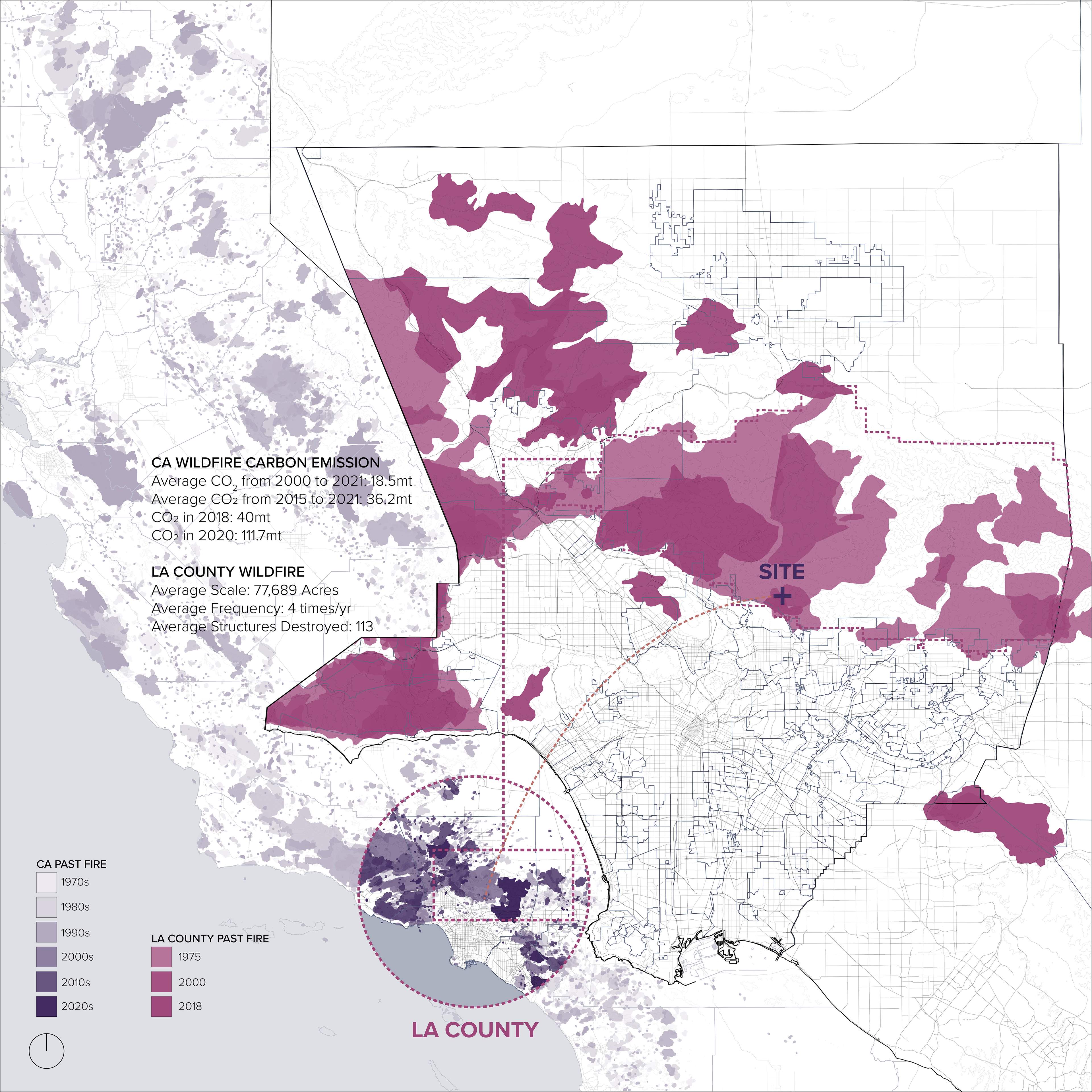
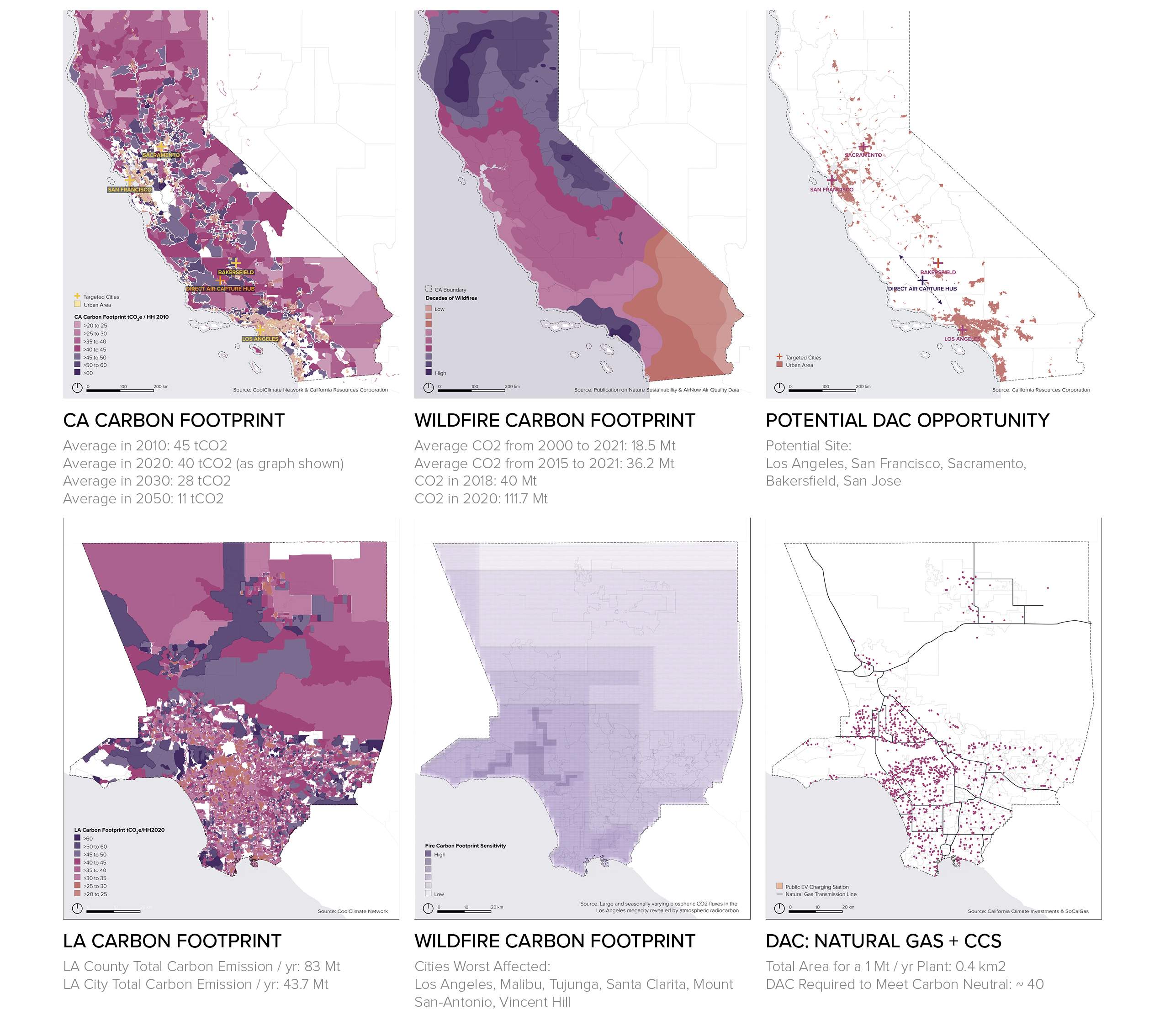
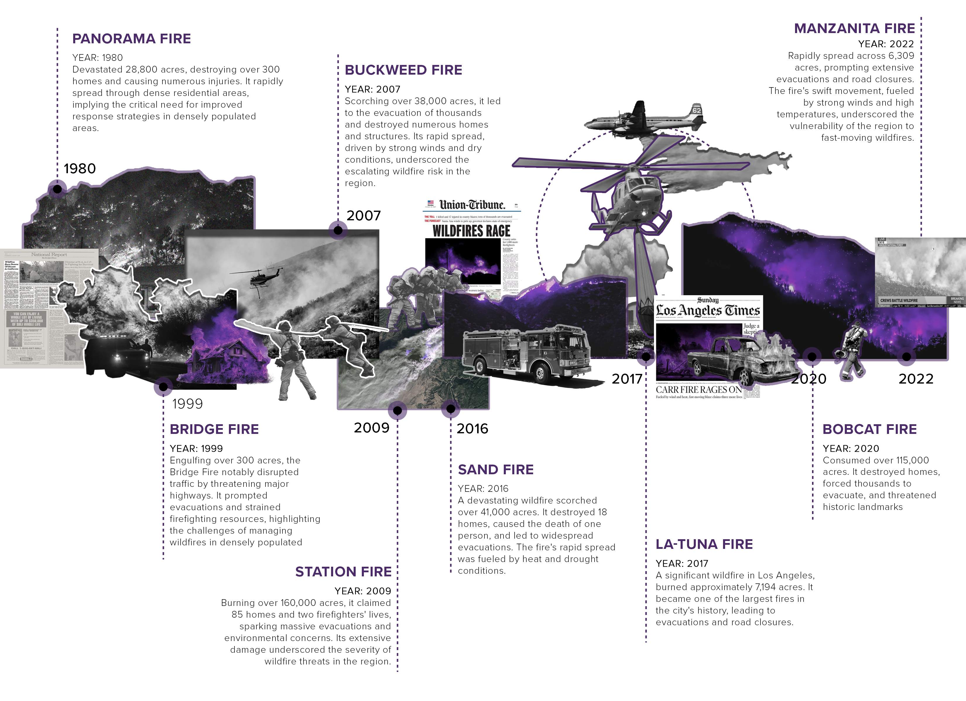
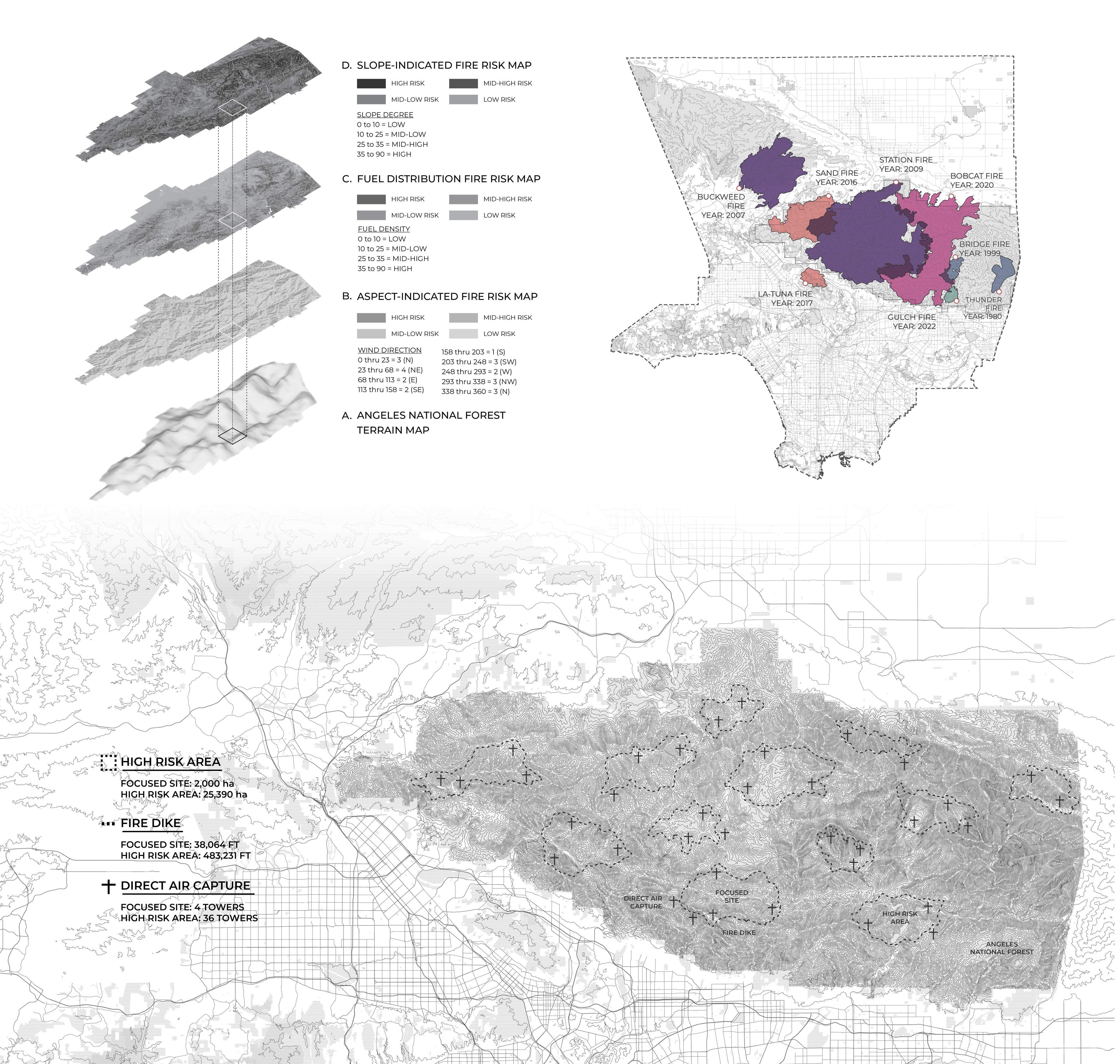
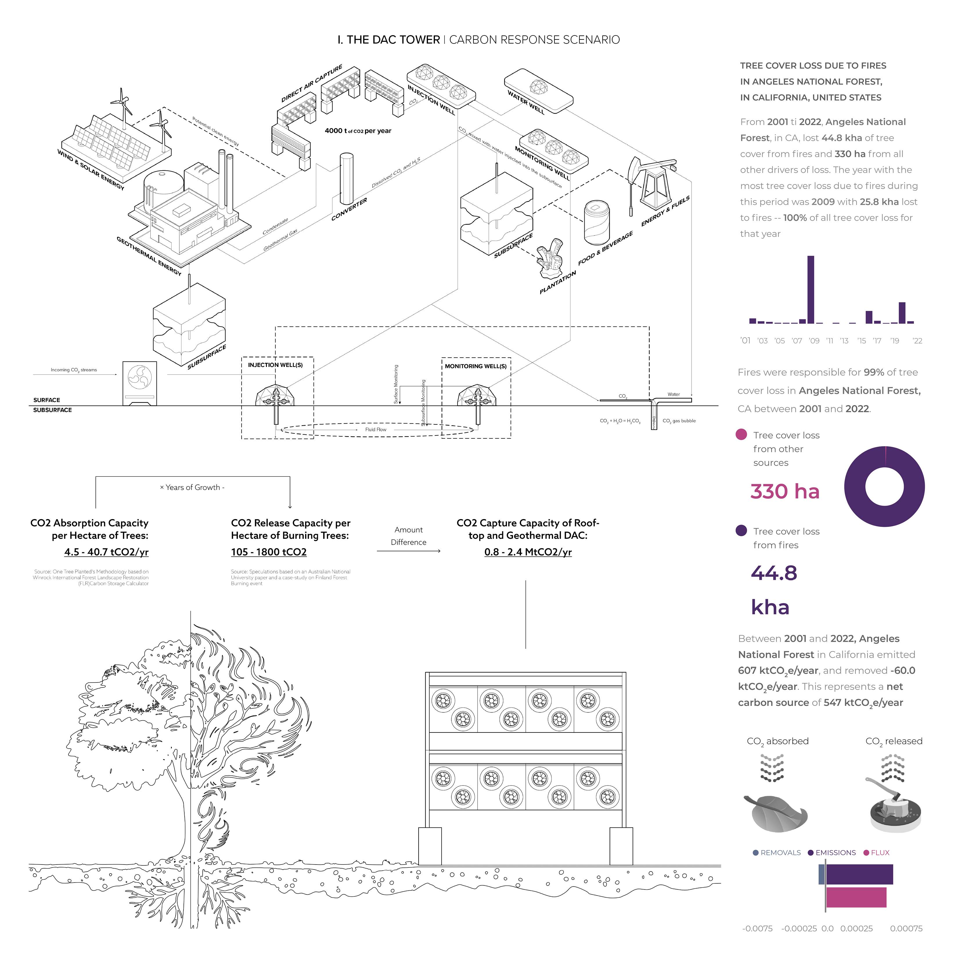
After gaining insight from fire-combat strategies worldwide, the project specifically addresses the challenge of carbon mitigation in the context of rampant wildfires in Los Angeles County, California, with a particular focus on the Angeles National Forest. This region, marked by its susceptibility to frequent and destructive wildfires, stands as a significant contributor to carbon emissions and a vital area for carbon capture.
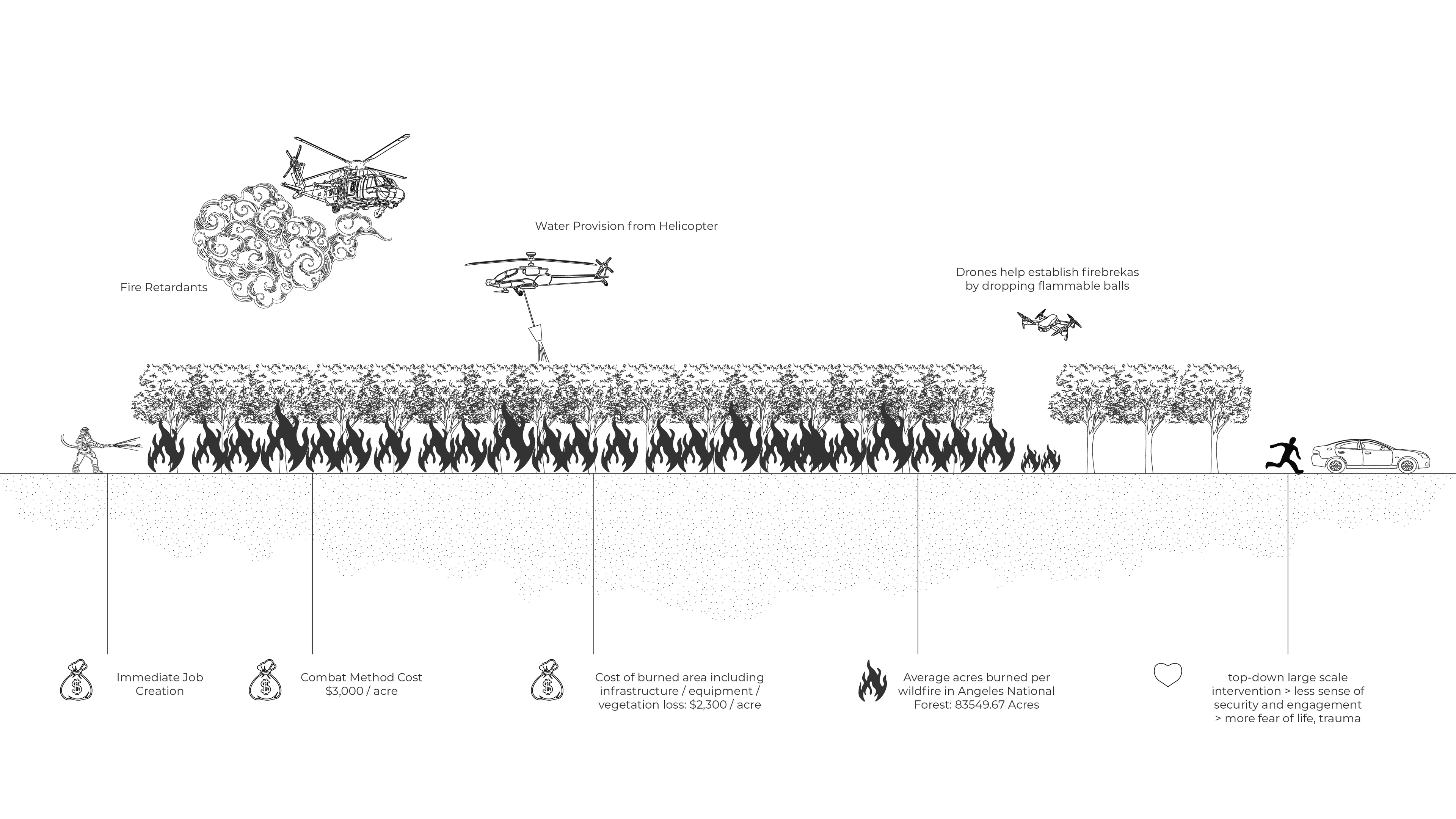
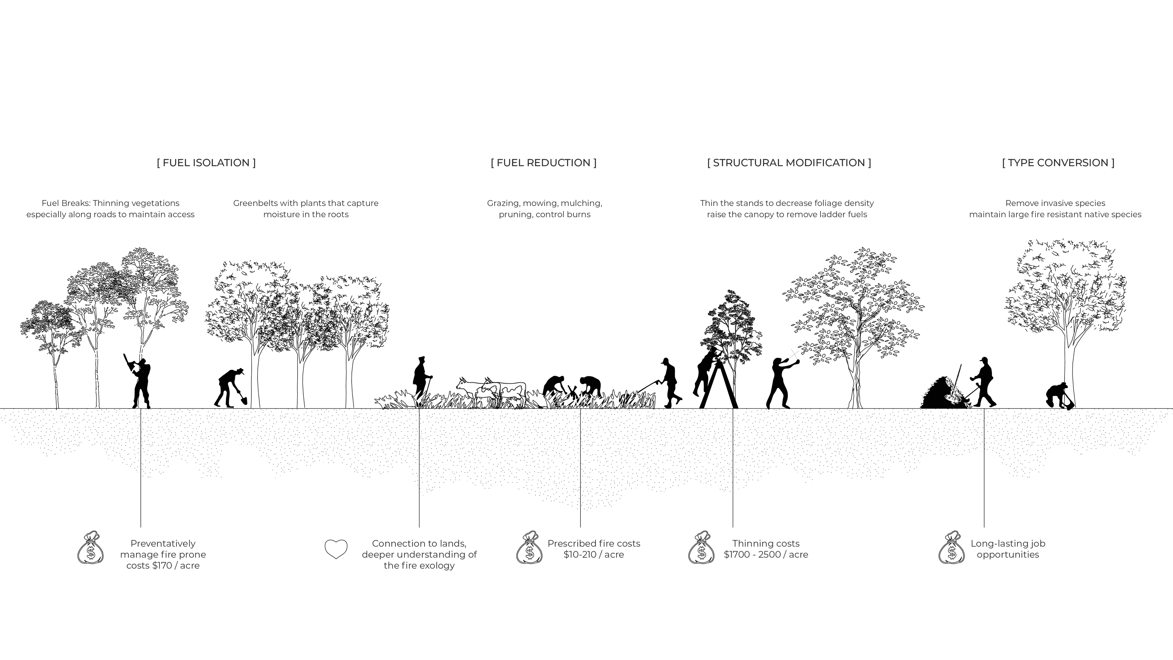
Decades of large-scale wildfires have devastated thousands of hectares in LA, destroying homes and ecosystems and incurring costs of hundreds of millions annually. Traditional combat methods, like fire retardant drops and firefighter dispatching, are expensive and not consistently effective. Inspired by indigenous land management practices, which involve nurturing vegetatioconducting controlled burns to maintainns for ecological balance, our project reimagines wildfire response. Recognizing that these fires account for 99% of tree cover loss and contribute significantly to carbon emissions, we propose treating wildfires as opportunities for ecological resilience rather than just natural disasters.
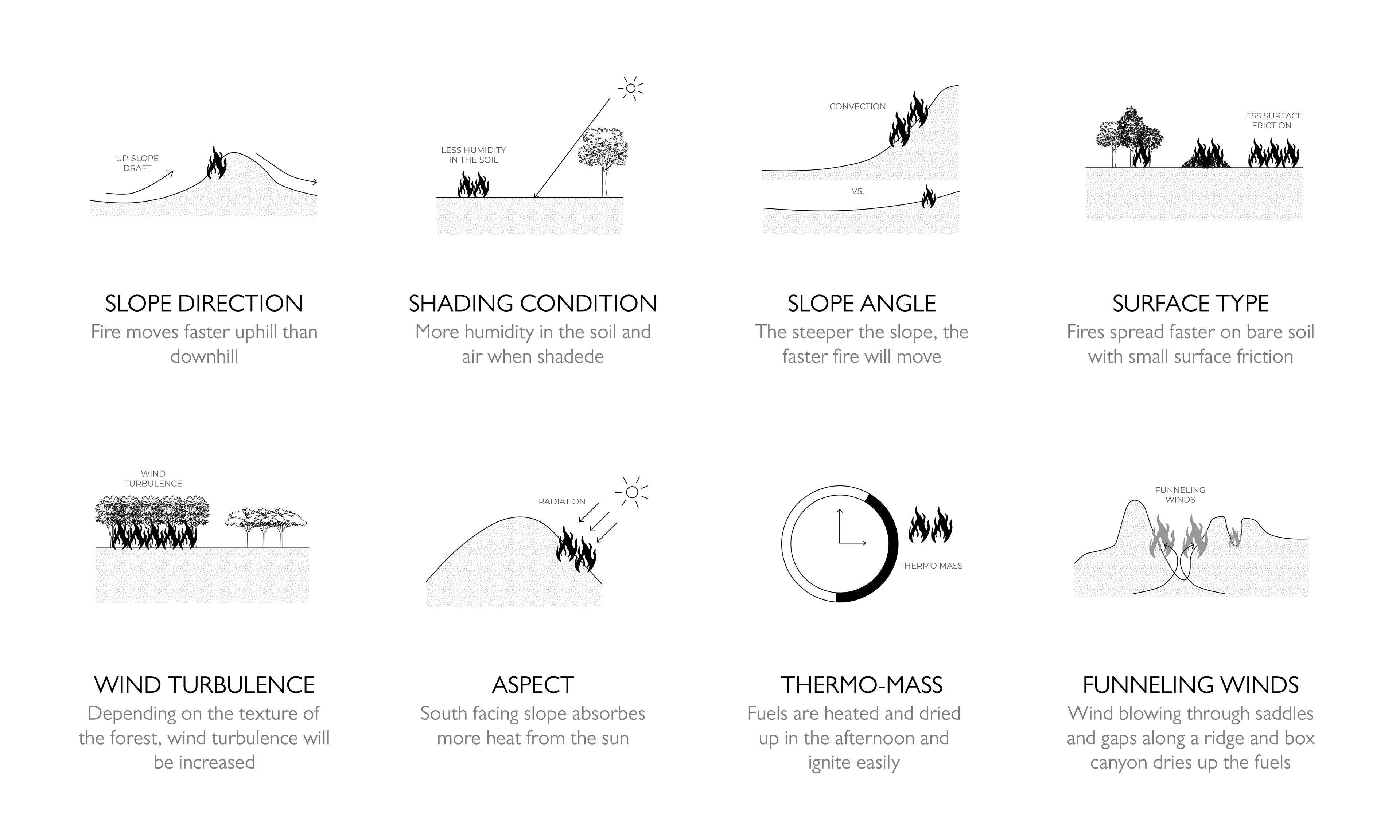
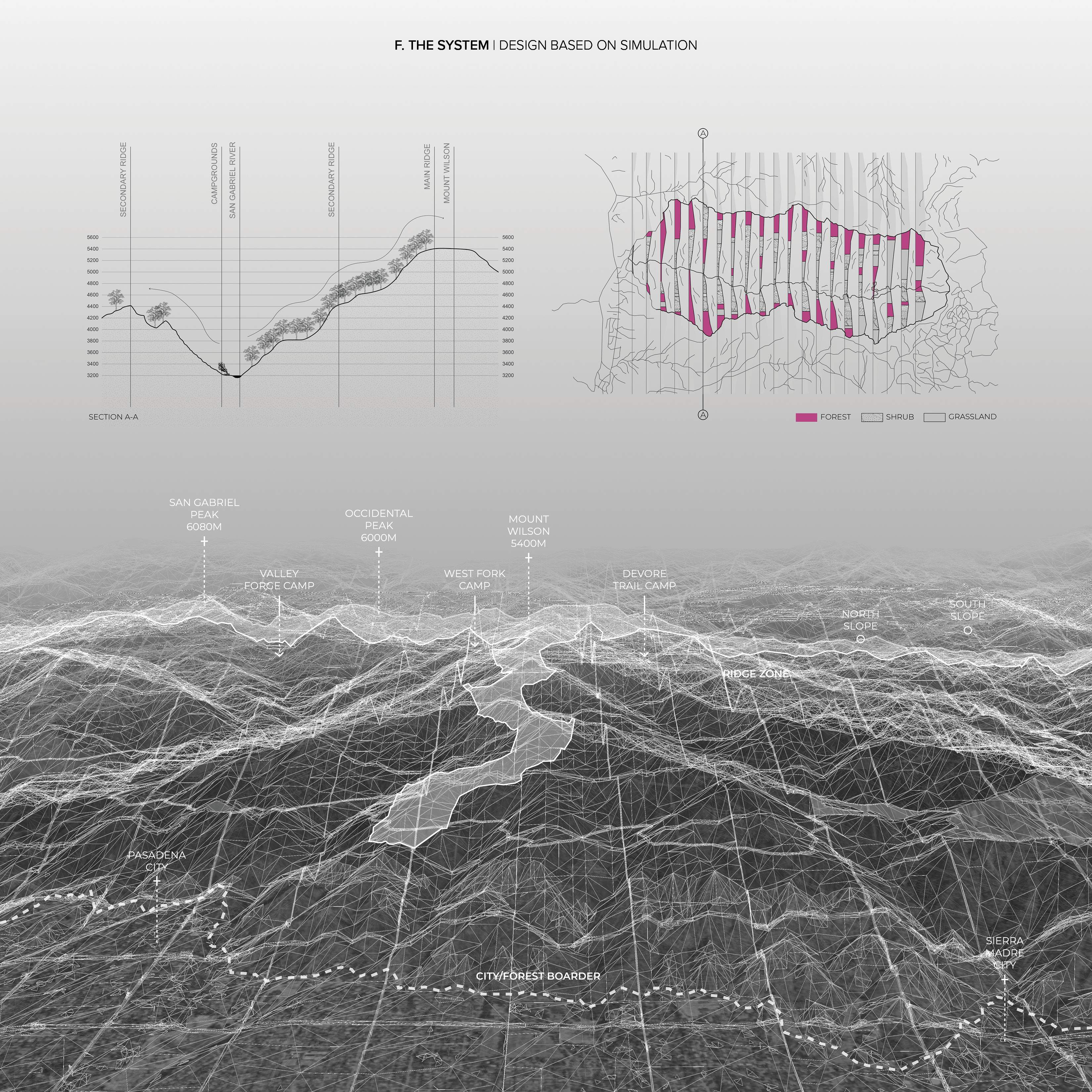
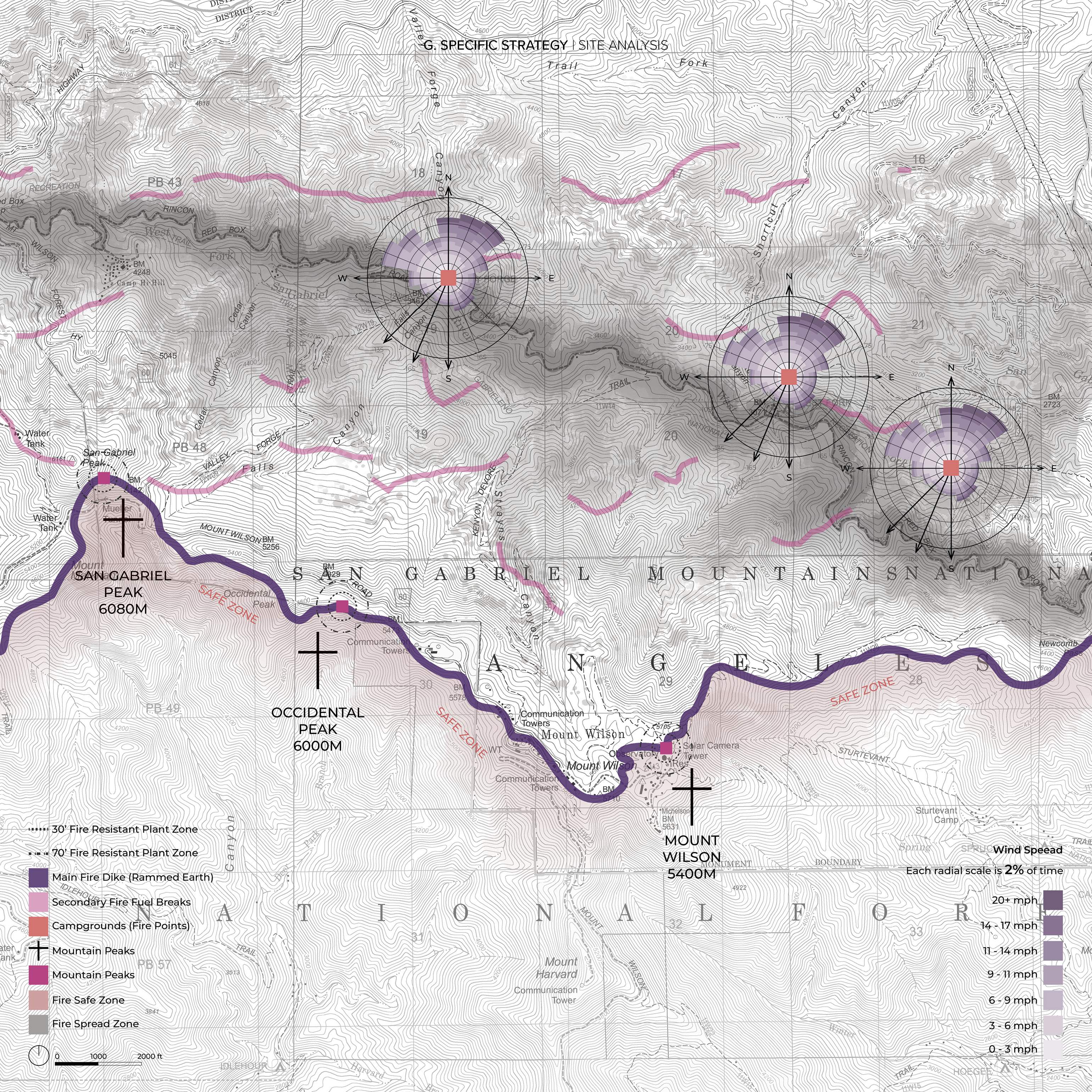
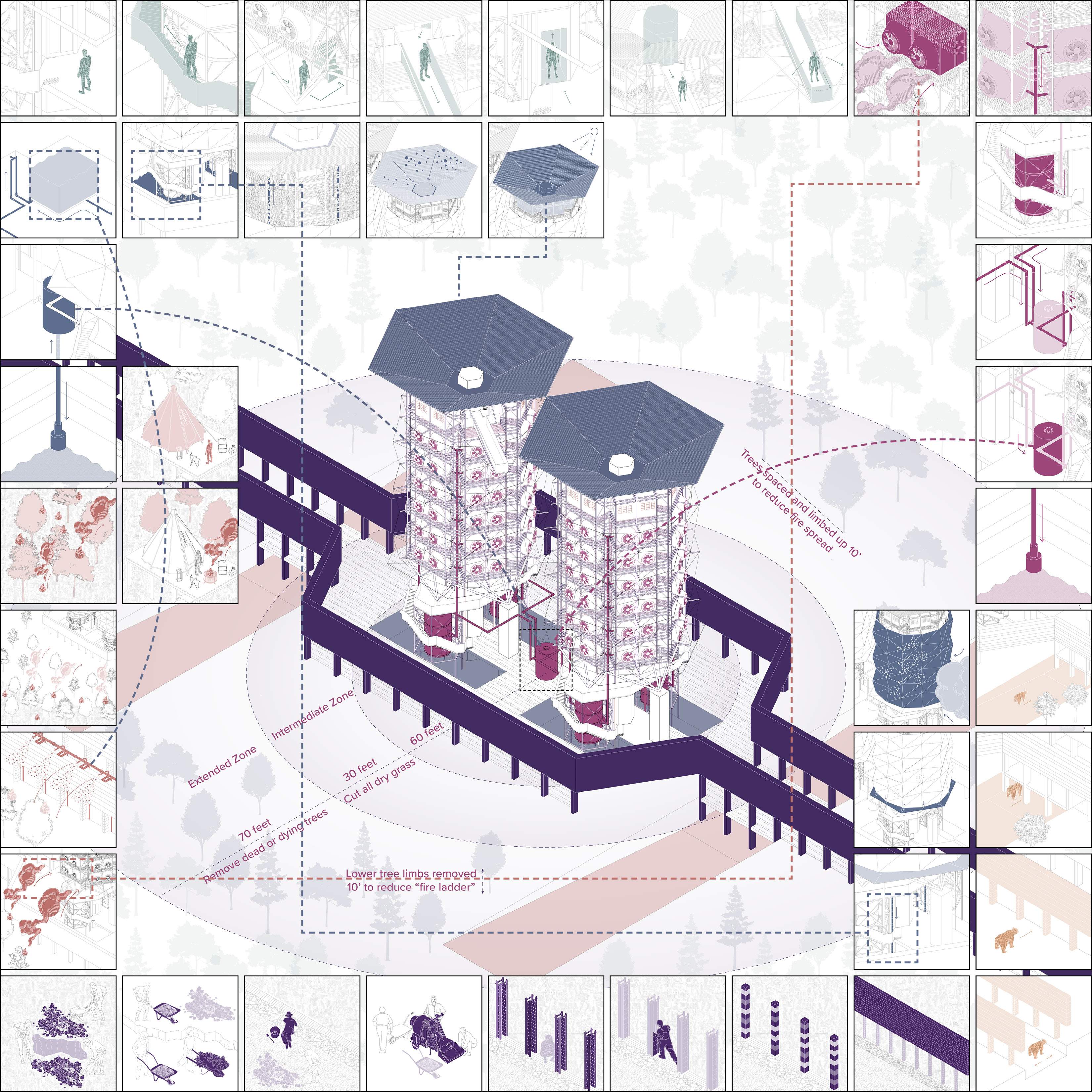
This project focuses on the Angeles National Forest, particularly the high-risk area near Mount Wilson. This involves assessing the forest’s orientation, prevailing wind directions, fuel distribution, and topography. Key features in this area include three fire camps and three prominent peaks along a major mountain ridge, collectively forming a crucial defense line against wildfires encroaching on urban areas.
THE SYSTEM
DESIGN BASED ON SIMULATION
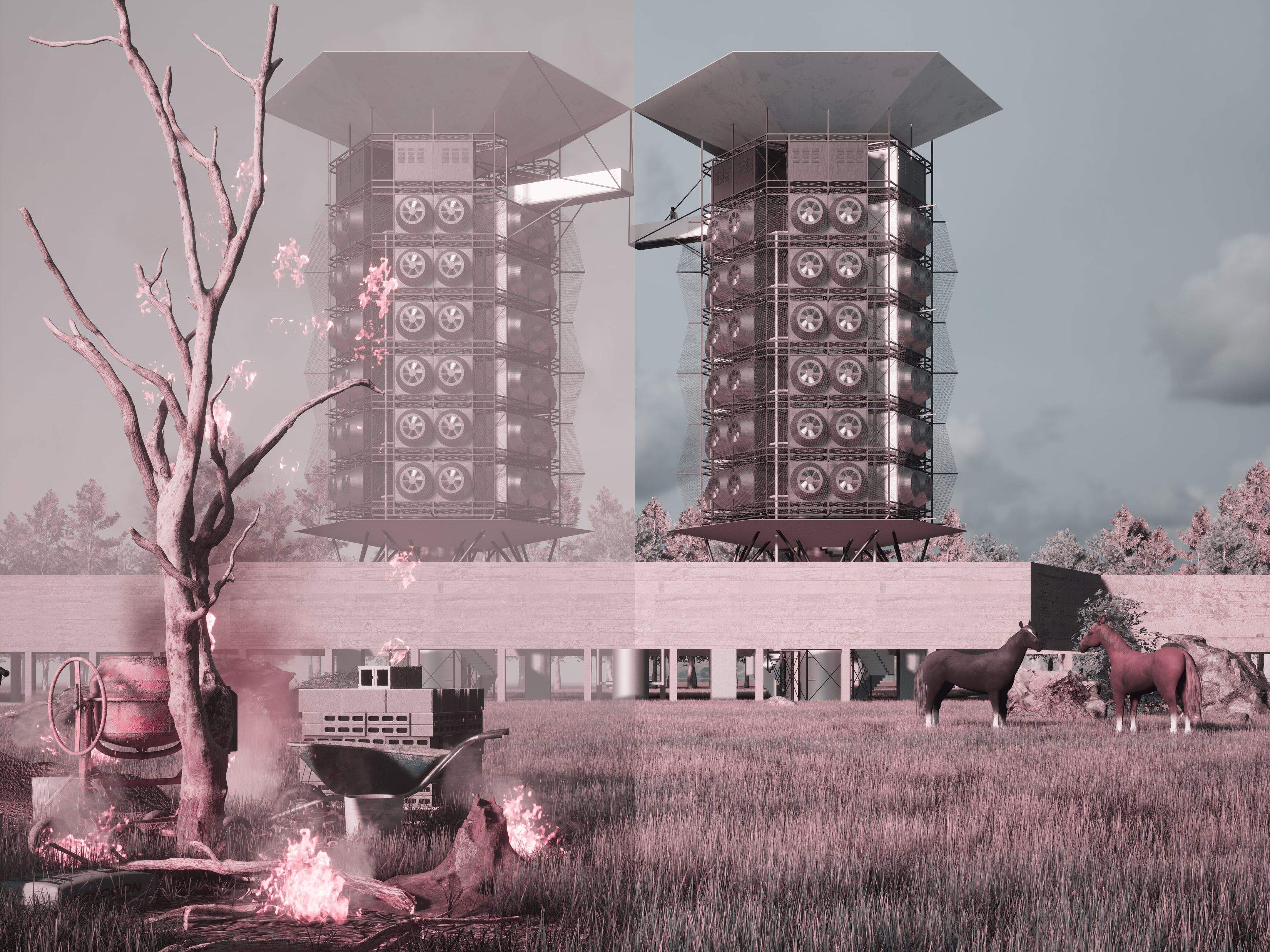
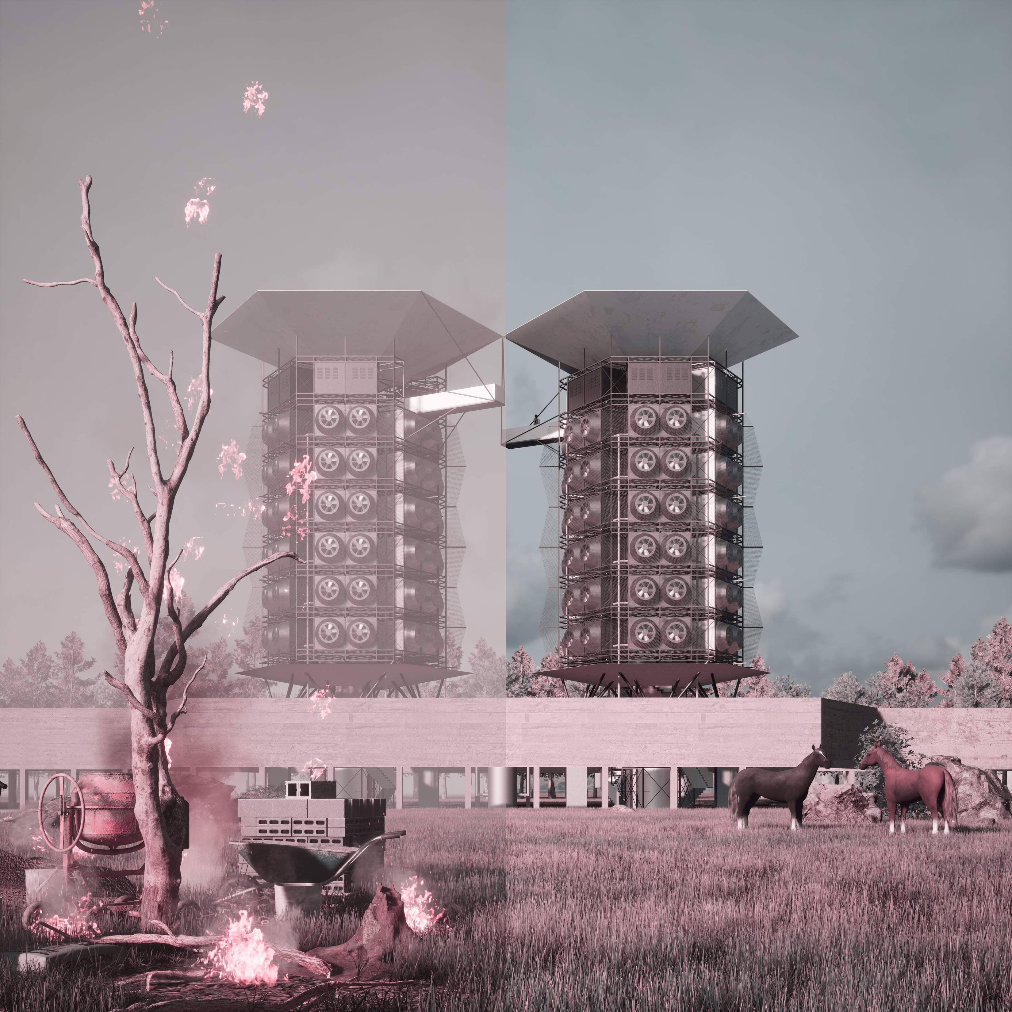
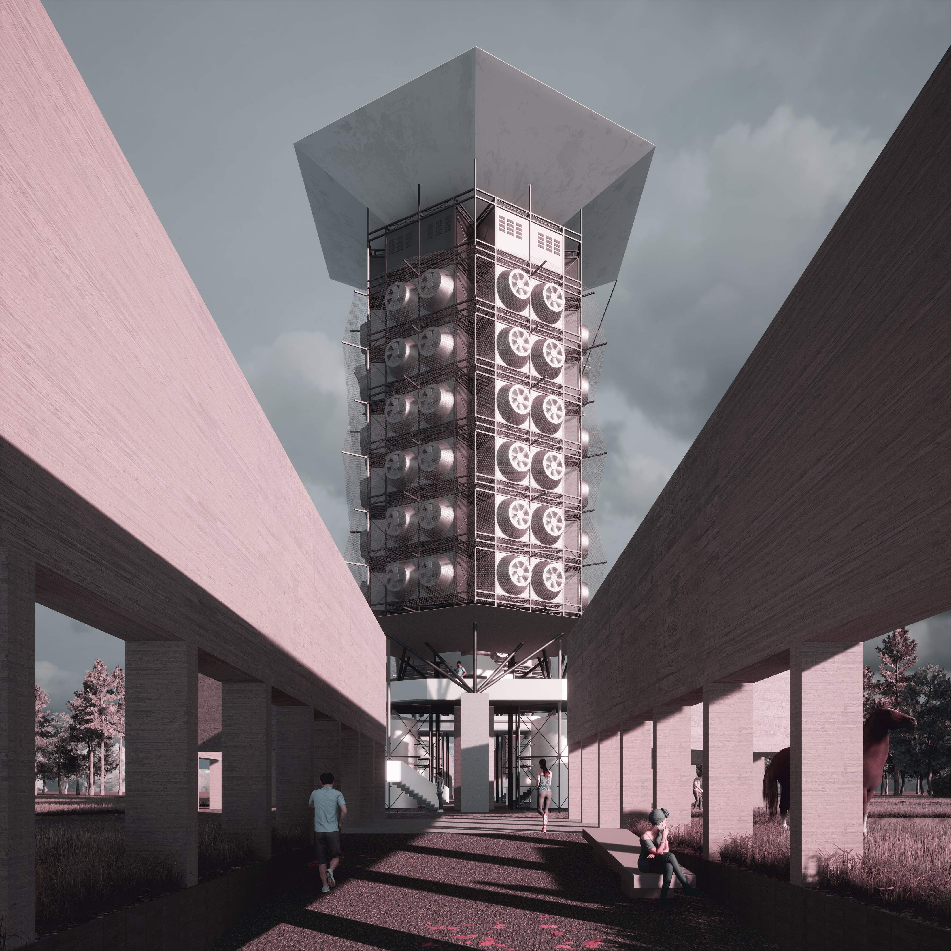
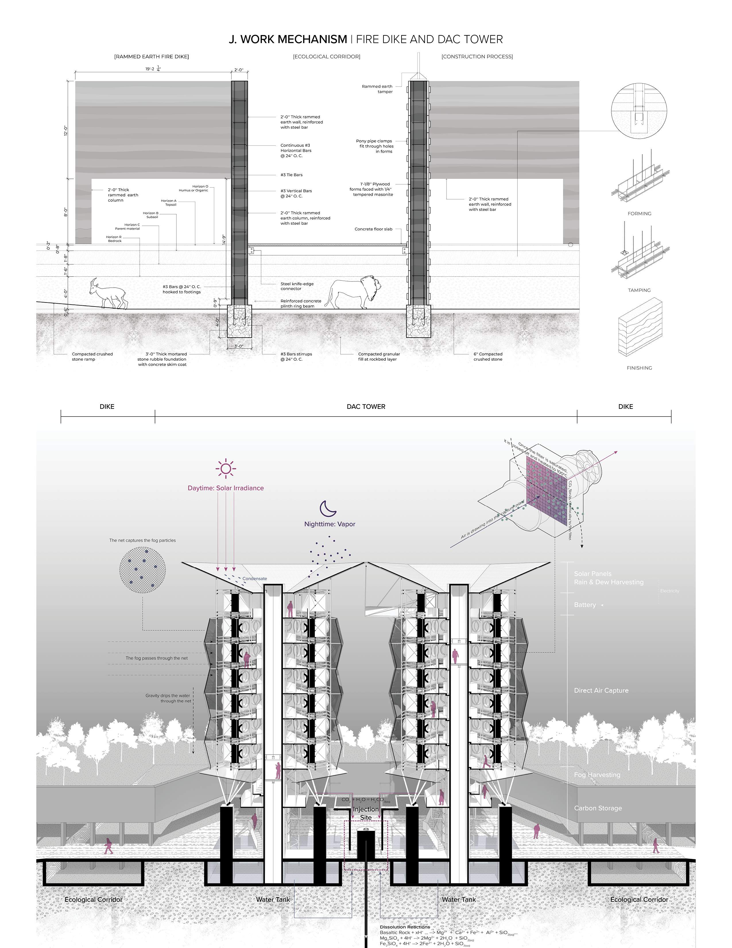
In the high-risk valley areas of the Angeles National Forest, characterized by wildfire acceleration uphill, our system introduces fire breaks along mountain slopes and a fire dike along the main ridge, extending east to west against the northeast winds. This system, featuring a fire dike made of rammed earth dug to bedrock, creates distinct fire spread and safety zones. Simulations show a 49% reduction in fire spread and significant CO2 savings. Our strategy includes Direct Air Capture towers at key peaks and is designed for replication across eleven identified high-risk sites within the forest.
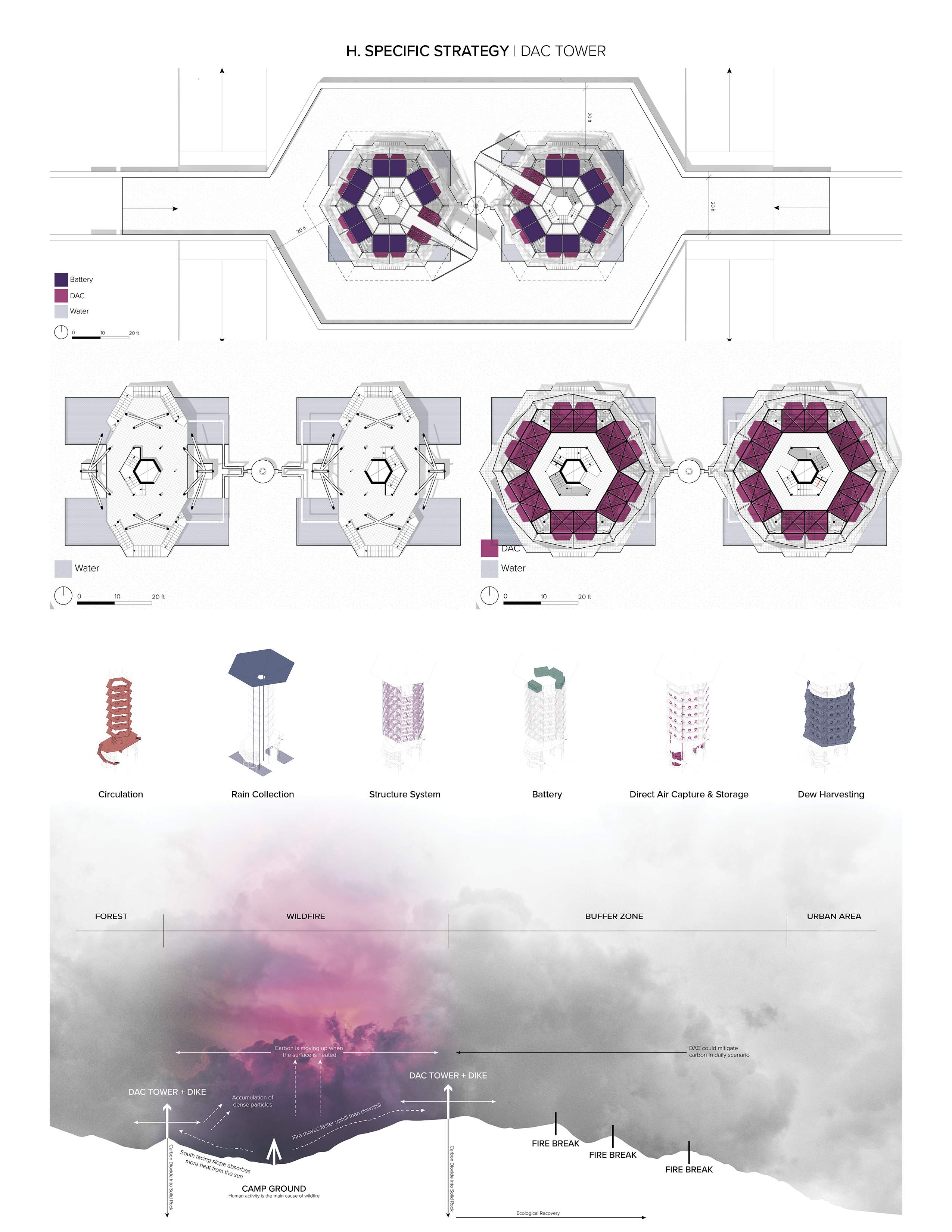
Leveraging interdisciplinary knowledge and state-of-the-art tools like digital twins, generative AI programming, and direct air capture technology, we propose a dual-system approach. Our proposal includes the construction of fire breaks and fire dikes, strategically designed to combat the spread of wildfires. In addition, we introduce Direct Air Capture and Storage technology at key mountain peaks, aiming to control wildfires and reduce carbon emissions effectively.
Beyond fire containment, the towers serve as multifunctional climate infrastructures: they capture atmospheric CO₂, harvest fog and rainwater, generate solar energy, and inject CO₂-water mixtures into subsurface storage. Public engagement is central—visitors can access elevated watchtowers and educational platforms, while ecological corridors ensure safe animal migration. These hybrid systems combine fire resilience, carbon mitigation, water management, and community participation into one replicable typology.
Looking into Future
The project situates itself in California as a representative example, with the potential to scale the data and conclusions globally. It transcends being merely a defensive strategy against wildfires, evolving into a proactive measure aimed at achieving net-zero emissions by 2050 in LA County. Ultimately, this project serves as a testament to the power of interdisciplinary collaboration, demonstrating how adaptive infrastructure can respond to risk through multifunctionality and resilience, aligning with the broader goals of The 2030 Project to bridge academia and real-world impact.